Respond Smarter
IncidentView makes it easy to know where you're going and what to expect when you get there. Features include automatic vehicle location (AVL), dispatch integration, address point search, local fire infrastructure, preplan display, and more.
Try the Free Demo
The demo app displays key features including fire fighting infrastructure, AVL, dispatches, vehicle responses status, routing, address point search, preplan display, and offline maps.
Overview
IncidentView is an easy to use, full-featured, cross-platform app for First Responders created to decrease response times, provide fast access to critical tactical information, and improve response coordination.
What sets IncidentView apart from other apps is how we use your own custom data for the most accurate information possible.
We have over 15 years of experience working with fire departments and first responders to create digital solutions that work for them.
See how IncidentView could work for you by watching the walkthrough video >>Features
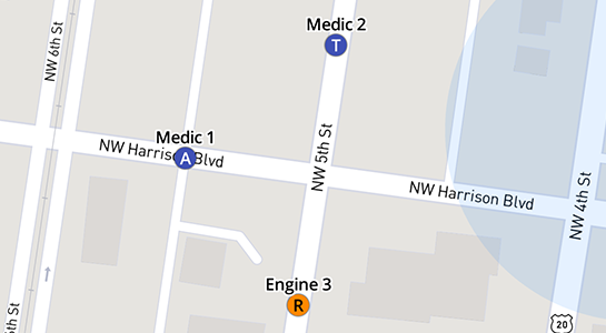
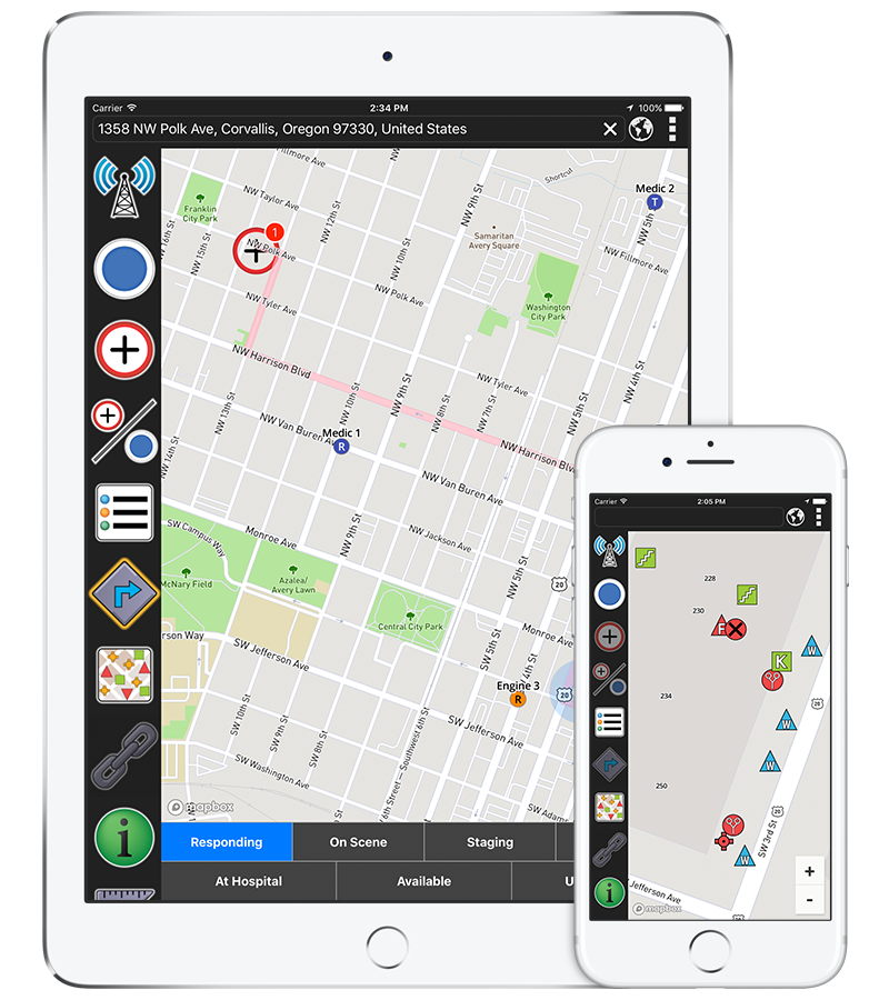
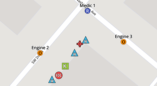
Automatic Vehicle Location
Display the real-time location and status of all your department's vehicles on the map for a safer and more efficient response.
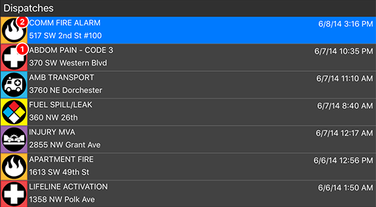
Dispatch Integration
Get live dispatch notifications, view full dispatch messages, and automatically display your destination on the map to reduce response times and provide critical tactical information.
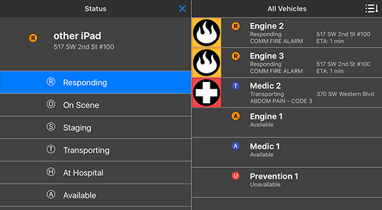
Response Status
View the status of all your agency’s vehicles, see all units responding to an incident and their route, and record your response times in order to better coordinate your units.
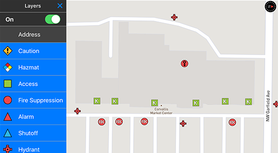
Local Infrastructure Data
IncidentView displays key tactical information on the map, such as hydrants, and allows you to tap on an icon to view more information about that feature. Contact us for a full list of features.
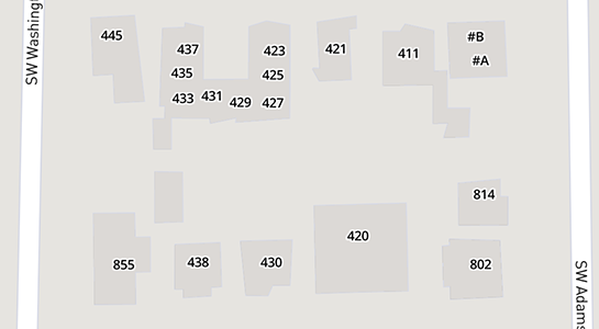
Address Point Search
In addition to being able to search for street intersections, landmarks, and GPS coordinates, IncidentView uses your local address data to improve the accuracy of search and dispatch locations.
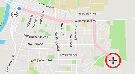
Routing and Navigation
Automatically display and update your location on the map using your device’s built in GPS or an external GPS. See real-time routing on the map or use Google’s voice navigation.
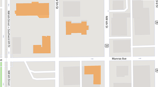
Preplan Display
Preplans and other digital information, such as pictures, can be hyperlinked to buildings and other map features. One tap on a building displays its preplan.
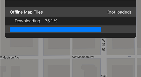
Offline Maps
Fully offline maps with infrastructure and preplan data allows you to use IncidentView when you don’t have an internet connection.
Shared AVL and Data
Agencies can choose to share their AVL and infrastructure data with neighboring agencies, in order to better coordinate inter-agency cooperability.
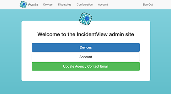
Admin Site
The IncidentView Admin site comes free when your agency buys IncidentView and allows you to view users and devices, change colors and names of devices, and change passwords.
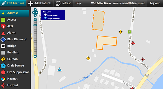
Editor Site
The IncidentView Editor site is an optional add-on that allows you to input and customize your own data so you can have the most accurate data possible. More info below.
Additional Features
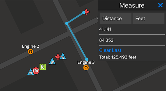
To learn about other IncidentView features, such as the various map views, the Measure tool, or the Coordinates tool please contact us for a demo.
Take Control of your IncidentView Data
Use Editor's tools to control and edit your fire infrastructure data and locations.
Reduce reliance on your over worked GIS department by updating and managing your data using Editor's tools.
Edit infrastructure such as hydrants, standpipes, access panels, shutoffs, key boxes, etc.
Modifications to your IncidentView data are pushed to your Windows, iOS and Android devices.
Already a customer? Log-in to the Editor
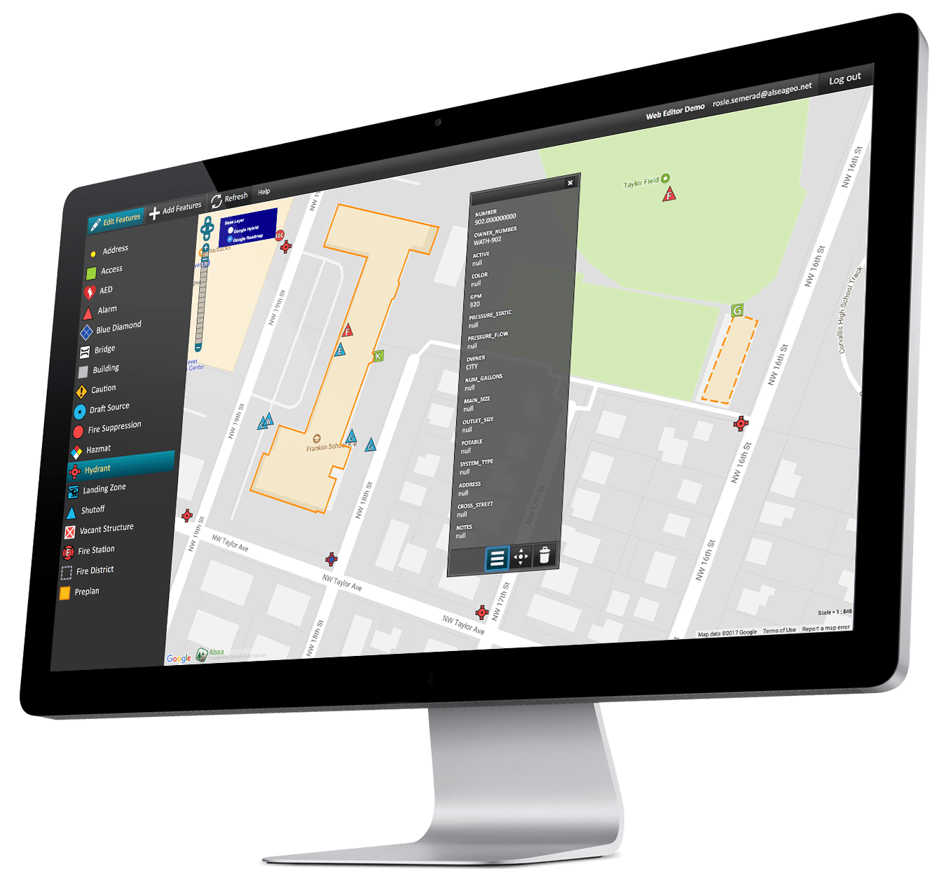

Add Infrastructure

Edit Attributes

Move Features

Delete Old Data

Load Preplans

Edit Geometry
Pricing


• Activation Fee - The one-time account activation fee covers registering your department and users with our system. It also includes the cost to obtain, process, and load your fire infrastructure data for the first time, as well as to integrate your dispatch messaging system with IncidentView.
Contact us
Contact information
Phone:
(541) 754-5034 x 102
Street Address:
421 NW 4th Street, Unit A
Corvallis, Oregon 97330
Mailing Address:
Alsea Geospatial, Inc.
P.O. Box 2380
Corvallis, OR 97339-2380
Company Website: